An accurate building information model of Rauma’s Äijänsuo ice arena to support design
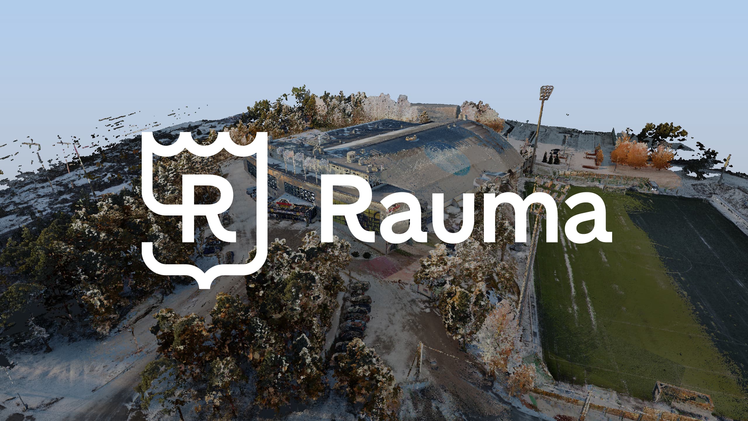
A screenshot of the point cloud data for the ice rink. Photo: eSite
An accurate laser scanning dataset and building information model (BIM) were produced of Rauma's Äijänsuo ice arena to support design. Extensive indoor and outdoor measurements, versatile data production, and careful quality assurance created an up-to-date baseline dataset that will serve the city’s renovation and development projects far into the future.
In late 2025, the City of Rauma launched assessments related to the development of the Äijänsuo ice arena and needed up-to-date and reliable baseline data to support design. The task was to produce a comprehensive laser scanning dataset and a corresponding BIM model of the ice arena, which was built in 1972 (and later expanded), to be utilized in further design and decision-making.
Laser scanning and BIM modeling as an integrated entity
An extensive indoor and outdoor laser scanning was carried out at the site and tied to the national coordinate system. Several methods and technologies were utilized in the measurements, such as total station surveying, mobile laser scanning, and drone imaging.
As a result of the laser scanning, an accurate point cloud dataset was produced, which was used to create a BIM model in the Autodesk Revit environment as well as in IFC format.
The base modeling followed the guidelines of the Common BIM Requirements (YTV 2012), which define the building’s spaces, main geometry, and structures.
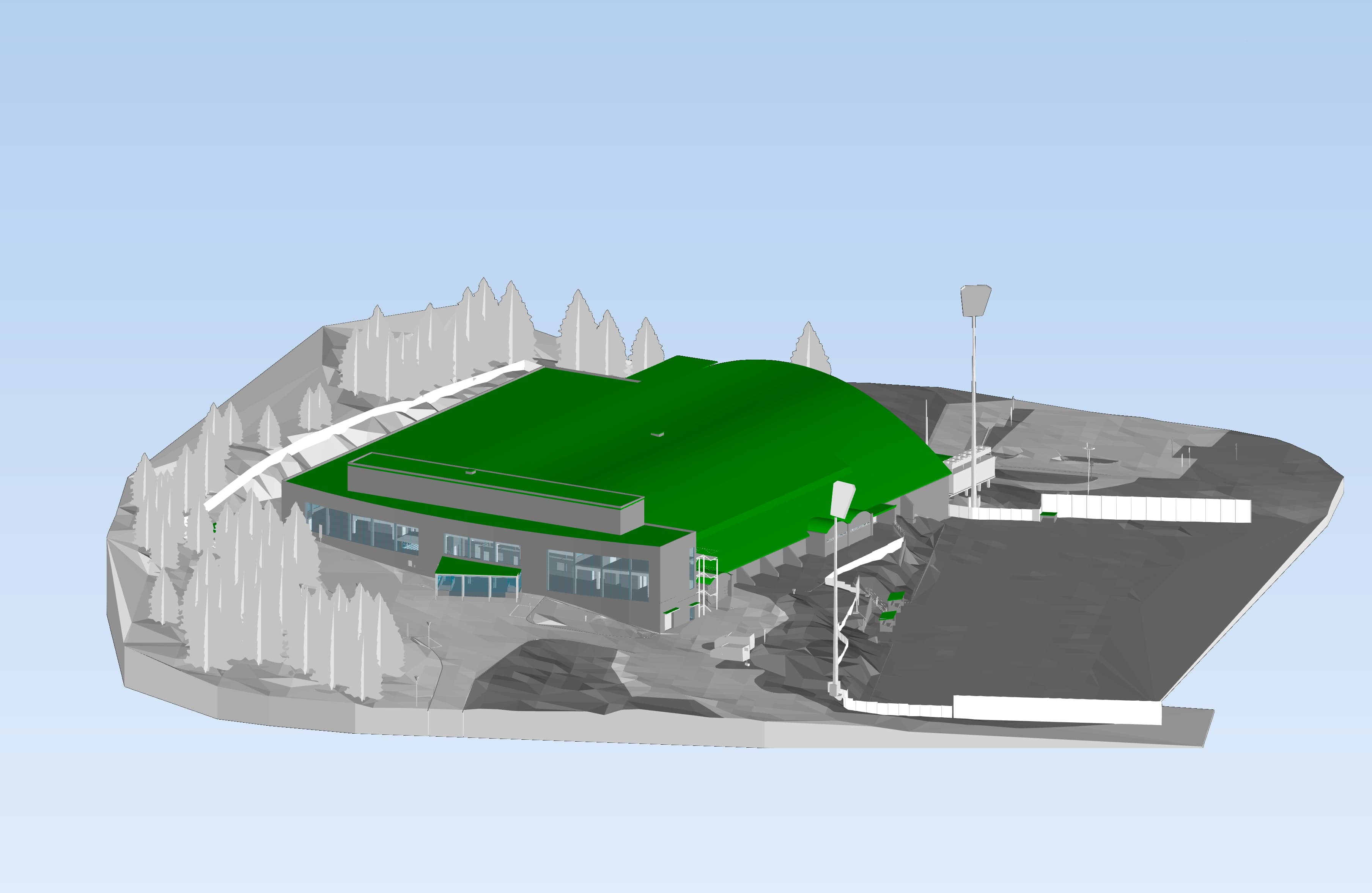
The initial data modeling followed the guidelines for data model requirements, which define the building’s spaces, main geometry, and structures. Screenshot of the data model. Photo: eSite
Implementation
The active use of the ice arena set special requirements for the planning and execution of the measurements. The measurements were scheduled to minimize disruption to the arena's normal operations and events. Taking place in the winter, the project also presented its own weather challenges, particularly for outdoor measurements.
The site's large surface area and multi-level structure required consistent measurement and modeling.
Benefits for the client
As a result of the project, the City of Rauma received an up-to-date and consistent baseline dataset that supports the design of renovation and development projects, reduces uncertainties and errors in the design phase, enables efficient collaboration between different parties, and serves as long-term documentation of the building.
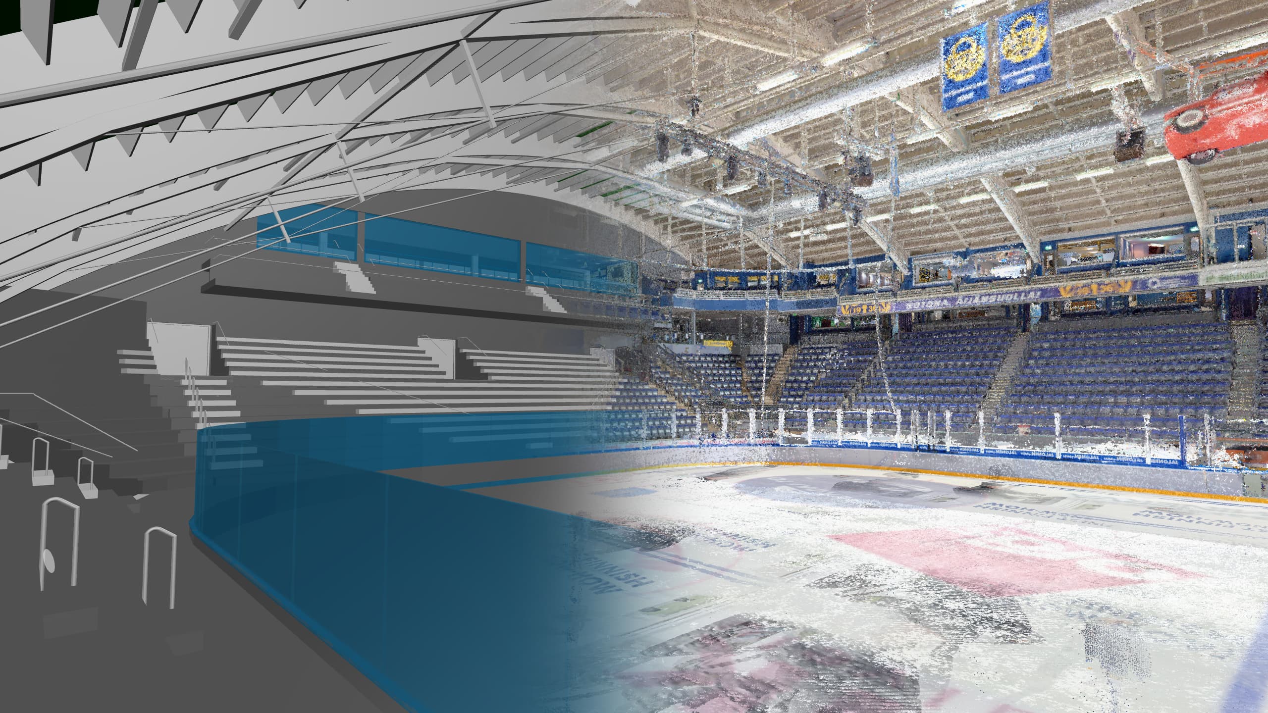
Based on the laser scanning and the resulting information model, we created a solution that will serve the client well into the future. Screenshot of the combination of the information model and the point cloud. Photo: eSite
Summary
The laser scanning and BIM modeling project of Rauma's Äijänsuo ice arena demonstrates how modern measurement and modeling methods can provide high-quality and efficient baseline data even for demanding and large-scale sites.
By combining precise laser scanning, versatile data production, and systematic quality assurance, a comprehensive solution was created that will serve the client well into the future.
“The building information model provides a clear and consistent overall picture of the ice arena's spaces and structures, which facilitates further design and reduces uncertainties in the early stages of the project.

Jenna Suomalainen
Solution Lead
+358 40 632 4435
jenna.suomalainen@mitta.fi